History
History of Decatur Lake
"One may come once and carry through life a precious memory of this charming nook in Wisconsin, this little silver lake and emerald isles set down amid broad fertile farms like the diamond glowing on the breast of beauty…"
Thus wrote Brodhead resident Helen Holmes Charlton in 1896 in an article called ‘Decatur Parks and Sugar River’ describing the beauty and uniqueness of Decatur Lake and the Mill Race shortly after their creation. Helen was highly intelligent and exceptional person; she served a term as the President of the Women’s Relief Corp for the State of Wisconsin, an organization that served as an auxiliary of the Grand Army of the Republic and represented our state in national conventions held in Washington D.C. in the late 1890’s. She had a gift for writing and her perceptive description of the Mill Race and Decatur Lake gives the reader a rare account of the value this beneficial resource provided the community at the turn of the century.
Helen’s published paper described a trip taken on a long slender ‘naphtha’ boat called the Nautilus piloted by Frank Northcraft, one of Brodhead’s founding fathers. For years, Northcraft powered his boat from the power station at the end of the Mill Race all the way to the northern part of Decatur Lake to take passengers to and from Brodhead to the numerous “parks” along the shores of Decatur Lake. In her words, “the ‘Parks’ are not parks in the city sense of the word, with wide gravel walks, spacious flower beds and signs ‘Keep Off the Grass.’” These parks were more like cottages with connecting trails promoting social interaction between the current residents enjoying the weekend. The owners of such parks as “Wooster Park”, “Fair Oaks”, “Camp Putnam”, “Fairview Park”, “Sherholskin” (from the owners names: Sherman, Holcumb and Skinner) and “Geneva Park”, would let their cottages for a nominal fee to people of the community to enjoy the lake when not in residence themselves. Usually throughout the entire summer 60 to 90 residents per week would enjoy the boating, fishing and swimming the lake provided.
Helen elaborates on her trip:
"On we go, we pass the headgates, and as we near the dam, you will see up on the hilltop at your left a pretty cottage set amid the trees; a winding, rocky path leads up the hillside to its inviting porch. Here the Solid Comfort Club hold possession and take their annual outing. Before us, up the river we can see Coney Island with its cozy cottage, the outdoor dining room extending out over the water, where the Coney Island Club rest and make merry."

Figure 1: Boat Landing at Fair Oaks, the Nautilus is boat on the left with cover.
Families would stay sometimes for weeks at a time communing with nature and enjoying the natural springs that fed the lake.

Figure 2: Coney Island as viewed from Fairview Park.
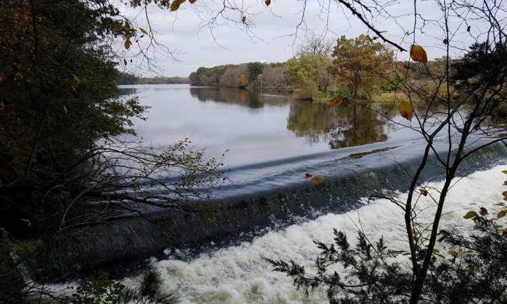
Decatur Dam
On January 29, 1847, an act of the Council and the House of Representatives of the Territory of Wisconsin authorized “William Jones to build and maintain a dam on the Sugar River in Green County” signed by Territorial Governor Henry Dodge. Mr. Jones built his dam, a saw and flour mill and plated a small town nearby the dam which became the town of Decatur.

Figure 3: One of the earliest pictures of Decatur Dam.
By 1857 Decatur had a post office, school, flourishing grist and sawmills, five stores, two hotels, two blacksmith shops, a wagon shop, a shoe shop, stage coach line and about four hundred inhabitants before the railroad established a depot in what is now the city of Brodhead. When the railroad depot was built between the towns of Decatur and Clarence in 1857, processed grain from the Decatur Mill had to be hauled by wagon to the newly made depot. Greater efficiencies would be made by relocating the mill closer to the depot and it could be said that the placement of the depot and the relocation of the mill signaled the demise of the town of Decatur.
However, the decline of the town of Decatur did not signal the end of Decatur dam. As inferred by Helen’s article above, the dam continued to remain useful as a recreational asset for the growing city of Brodhead, and the newly built mill race provided a means of access to “this little silver lake”.
Mill Race
By 1859, the Decatur Mill was owned by the John and Thomas Hendrie, and they wished to move the mill closer to the Brodhead depot if water power could be made available. Plans were made to create a mill race and in 1860, hand shovels, mules and horse drawn scrapers dug a ditch 65 feet wide at the bottom and 80 feet wide at the top of the water surface to create a mill race. All of the land necessary to create the mill race was purchased by the city and water was let into the mill race on May 6 1863. With the creation of a newly made flour mill and electric power station, Brodhead became the center of agriculture and industry for the area.

Figure 4: End of the Race (l to r, back to front) Plow Factory, Mill, Electric Light Plant and Pumping Station
Brodhead was an early leader in producing electricity and was said to have electric power before the city of Chicago. After the mill burned down, a power station was built to provide power to Brodhead until 1965.

Figure 5: Brick Power station built on site of old flour mill.
This tradition continues today as the city of Brodhead still has its own Water and Light Utility although no power is currently generated by the city owned mill race.
Organization of the DLMRA
History
In the summer of 2011 a group of concerned citizen met in the Decatur Town Hall to establish an organization to address the sedimentation issues that were affecting Decatur Lake. The refurbished dam was in existence for about 10 years, and pronounced sedimentation of the lake was affecting the boating, fishing and swimming in the lake. In that meeting, run by Frank Gombar, four officers were elected to organize this effort. They were:
John Winters- President
Keith Krause- Vice President
Jaine Winters- Secretary
Kathy Foslin- Treasurer
In a series of meetings, the focus of effort was expanded to include the Mill Race, and a Board of Directors was established to administrate policy to address the lake and mill race issues. These board members were:
George Downs- Director
Frank Gombar- Director
William Hedges- Director
Grant Killoran- Director
Elizabeth Pfluger- Director
Erin Shea- Director
Richard Tripp- Director
Lorraine Williams- Director
One of the first acts of the Board of Directors and its officers was to create committees to administrate policy determined by the board. These committees and their chairpersons were:
Finance Committee- Lorraine Williams
Lake Improvement- Richard Tripp
Legal Committee- Grant Killoran
Public Relations- George Downs
Social Committee- Frank Gombar
Water Quality- Norman Williams
On November 12, 2011 the Board of Directors presented a set of Bylaws to the DLMRA membership for ratification and the DLMRA was officially born. Paperwork by our legal and finance committees established our group as a non-profit organization and as a ‘Qualified Lake Association’ after our first year of existence.
Today
DLMRA is working to support the city in its effort to promote and improve the Mill Race. Our organization has supplied manpower and equipment to the race cleanup. We also have supplied manpower to the WAV stream monitoring program and will continue to support these efforts in the coming years. In conjunction with this effort we are starting to plan how to improve the lake and link the lake improvement plans with the goals of the mill race project.
Description of Decatur Lake and the Mill Race
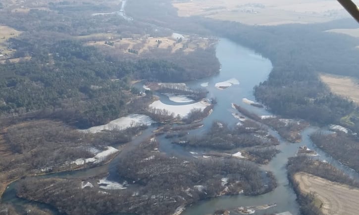
Below is a map of the Decatur Lake, the Mill Race and its environs. It is a bird’s eye view of the area requiring restoration. Originally, only the Decatur Dam was built, but within 15 years of the construction of the dam, the Mill Race was dug. The Mill Race is approximately 3.5 miles long and runs from the head gates at the mouth of Norwegian Creek to the western border of the city of Brodhead. “Decatur Parks” no longer exist but the approximate locations of the past parks are located on the map for referential purposes.

Figure 1: A bird’s eye view of Decatur Lake and Mill Race
In 1985 the dam was slated for repairs and it was questionable as to whether the dam should be removed or preserved. An organization called the Decatur Lake Preservation Association (DLPA) was created to preseve the lake and dam and worked tirelessly to accomplish this task. Led by President Bruce Timm (a successful Brodhead businessman and previous Mayor of Brodhead), the organization successfully preserved the dam and lake.
Unfortuately, due to economic and environmental restrictions, some compromises were made in design of the dam that precuded the ability to drain the lake and allow for sediment removal. Currently, lake sedimentation has become a serious issue for lake accessiblity and enjoyment which subsequently inspired the formation of the Decatur Lake and Mill Race Association (DLMRA).
Current State of the Mill Race
The Mill Race celebrated its 150th anniversary in 2013 with an excellent and informative museum display developed by the Brodhead Historical Society. This display (designed and produced by Carol Gombar) underlines the importance the Mill Race to the emergent city of Brodhead.

Figure 2: The Mill Race from the Headgates to the TailRace
A map view of the mill race clearly indicates the value of the Mill Race to the City of Brodhead. Since its creation during the height of the Civil War in 1863, the Mill Race has provided support for the agricultural industry until 1929 and electrical power to the city until 1965.
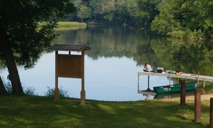
The loss of Woodbridge Corporation in 2009, an industry that at one time hired 485 employees from within our area, has had a profound economic effect on the city and has prompted a reevaluation of its assets including the value of the Mill Race. Currently, the city procured a $350,000 matching grant by the Wisconsin Department of Natural Resources (DNR) to improve the Mill Race. The project is called the Pearl Island Restoration and involves improving the accessiblity of the mill race for the general public. Plans include the building of a bike trail along the race with picnic and restroom facilities, docks and piers and improved aquatic habitat for better fishing, and a general cleanup and deepening of the race for controlled boating, kayaking and canoeing.
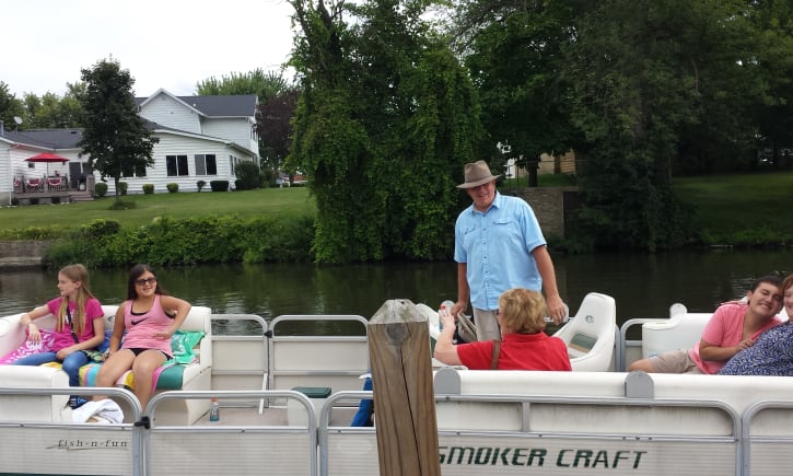
Much work has already been done to clean the area along the race by community members the value of this work to be put against the matching grant for further mill race improvements. In 2012 during Covered Bridge Days in Brodhead, the first annual ‘Embrace the Race’ event occurred. Sponsored by the Brodhead Chamber of Commerce and the DLMRA, over 600 people were boated from the tailgate spillway to the headgates and back. Utilizing a fleet of 5 pontoon boat with captains and tour guides, the patrons were treated to a cultural and historic tour of the race as they admired the wildlife and natural beauty the mill race provided. The event was a great success in improving public awareness of this beautiful natural resource and the Chamber of Commerce and DLMRA plan on continuing this event.
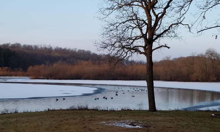
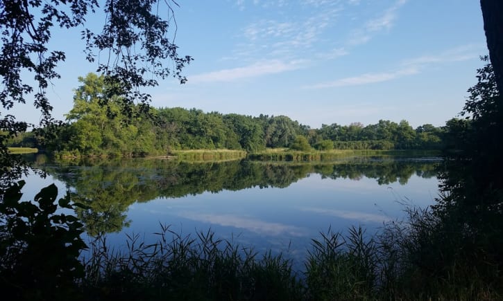
Current State of Decatur Lake
Decatur Lake is fed by 3 primary tributaries, the Sugar River, Searles Creek and Norwegian Creek. All three tributaries contribute sediment to the lake and the current state of Decatur Lake is one of duress. There is no system in place to eliminate to sediment in the lake. Also, there is limited access to the lake by the public; by vehicle, there is only 1 public landing site for boats near the southern most part of the lake. Boats can access the lake through the Headgate from the south and via the Sugar River from the north.
The depth of the lake has decreased significantly since the refurbishing of the dam. Two islands (one of them being Coney Island) that existed since the establishment of the dam have disappeared.
Since the restoration of the dam, the definition of the Decatur Dam and Lake has been redefined to include the berm extending from Decatur Dam proper to the Headgates.
Below is a map of the lake describing landmarks, tributaries, and previous historical points of interest and the definition of the dam and lake:

Figure 3: Annotated map of Decatur Lake